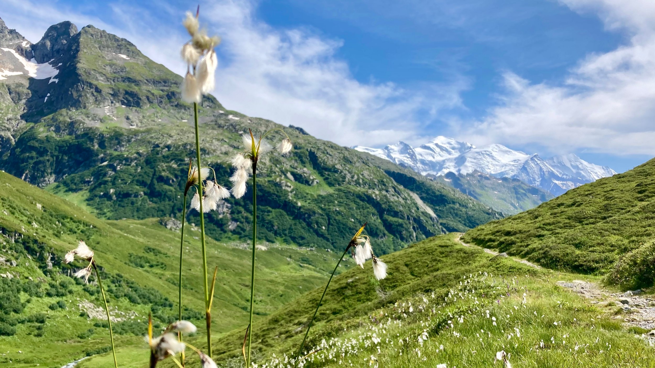
Welcome to Part Two of our Chamonix Trail Running Guide! Whether you’re visiting for the first time, planning your first trip, or returning to explore more, this guide will help you discover some incredible routes – all available on Chamonix All Year Strava account!
Always pack water, snacks, and cash. Make sure to leave a note in your accommodation or with a friend about where you are heading and when you will be back. Poles are often recommended for steep climbs, and always pack a spare jacket and an extra layer, even if you’re starting in 30 degree temperatures, as the weather in the Alps can change rapidly. You can check current mountain conditions and weather at the Maison de Montagne, next to the church in the centre of Chamonix. Discover more about scenic routes and possibilities with the Mont Blanc Express.
For accommodation, Chamonix All Year offers a variety of chalets and apartments. If you are looking for a chalet or apartment, click here and find your home away from home.
Montenvers to Midi Traverse
- Distance: 6 km (or 18 km if not using the lifts)
- Elevation Gain: 456 m (1,228 m if not using the lifts)
- Difficulty: Easy (Moderate)
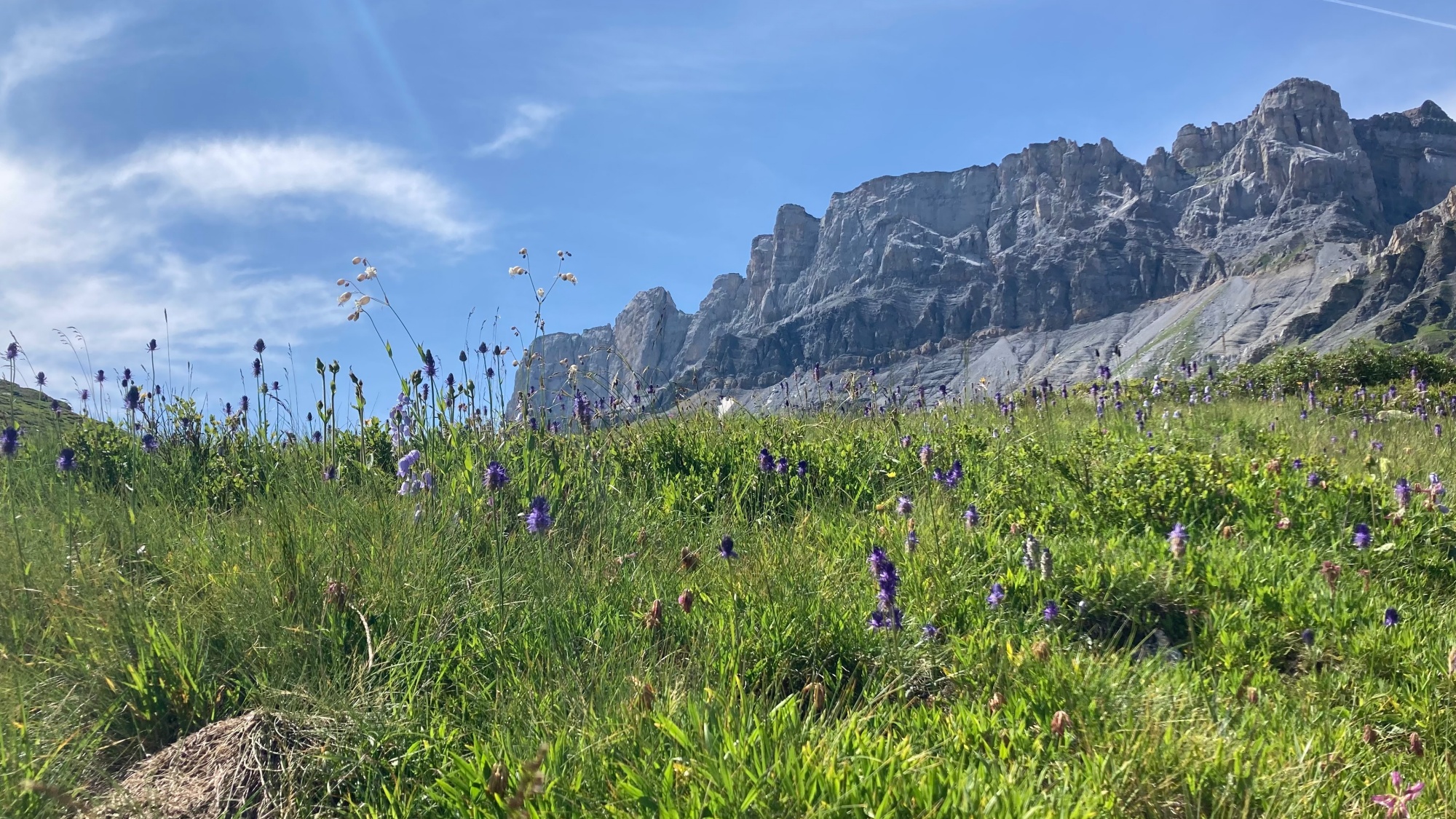
An absolute staple run popular with visitors of all ages due to its easy access and combined lift ticket options. Start by taking the little red train to Montenvers, run across the Grand Balcon Nord and then descend by cable car from Plan de l’Aiguille.
The route shown here details the full loop, starting and finishing Chamonix, but you can shorten it by taking the train and cable car on the way down. Remember to stop a few metres below the Midi cable car station at Refuge du Plan de l’Aiguille for an amazing tarte aux myrtilles.
Plan Praz to Flégère
- Distance: 5.5 km
- Elevation Gain: 179 m
- Difficulty: Easy
An absolute classic when you want to run high without climbing 1,000 metres. Take the cable car to Plan Praz and run the Grand Balcon Sud to Flégère, where you can take the cable car back down. This route is so popular that combined lift tickets are available. Enjoy beautiful views on all sides. The terrain is neither too steep nor too mellow, but be aware that it can get busy in the summer months due to tourists. Lac Blanc is also accessible from this area but similarly tends to be busy with visitors.
The Petits Balcons to Argentière
- Distance: 18.5 km
- Elevation Gain: 387m
- Difficulty: Easy
When you want a longer run without climbing every peak, the Balcons Sud and Nord to Argentière provide just that. Start in Chamonix and stay low until you reach the golf course (avoid running on it). Follow the river through Paradis des Praz and continue following the Petit Balcon Sud all the way to Argentière. Stop by a bakery for a treat and then turn towards the Petit Balcon Nord. The route is pleasant, mostly under the cover of trees. Take in the scenic village of Le Lavancher and don’t forget to snap some photos of the gorgeous views you’ll enjoy along the way. The return to Chamonix takes you through the Bois de Bouchet to arrive near the sports centre.
Tour of the Lakes
- Distance: 27 km
- Elevation Gain: 2,071 m (1,071 m if using the lift)
- Difficulty: Hard
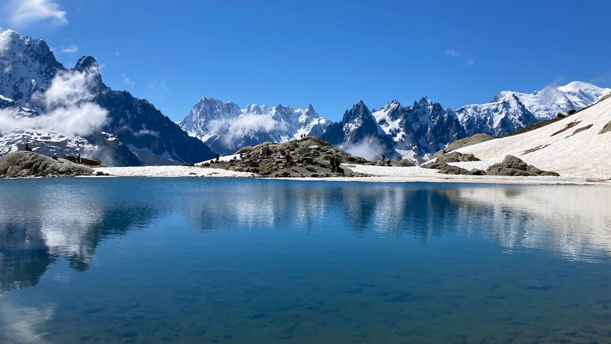
For fans of alpine lakes, start by hiking up the infamous VK (Vertical Kilometre) trail or take the cable car to Plan Praz. From there, follow the path up to Lac Cornu, where you can enjoy the serene views or have a picnic. Return to the main path and continue to Col de la Glière and Lac Noir. Follow the path from the col towards l’Index and on to the Refuge du Lac Blanc for incredible panoramic views. Note that Lac Blanc can be very busy in the summer due to its popularity and easier access from the Index chairlift. Descend towards Lacs de Cheserys and return to Chamonix via Flégère, following the route of the UTMB towards La Floria, a beautiful place to stop for a drink and another tarte aux myrtilles. You can also take the cable car down from Flégère.
Chamonix to Servoz Loop
- Distance: 21 – 29 km
- Elevation Gain: 903 m
- Difficulty: Moderate
This route offers a lovely alternative to the Balcons Sud and Nord, heading in the opposite direction from Chamonix to Servoz. Start by running along the river path towards Les Houches, which is part of the UTMB route. Ascend towards Montvauthier and enjoy the solitude of these little-trodden trails. Experience breathtaking views as you emerge from the forest. Descend towards Servoz, cross the Arve river and pick up the trails which once served as the main road to Chamonix. Follow the train line as you pass Vaudagne to arrive in Les Houches, where you can take a bus back or continue along the river path if your legs are up for the challenge.
Chalets de Chailloux
- Distance: 9 km
- Elevation Gain: 807 m
- Difficulty: Moderate
Starting at Les Houches train station, you climb through Le Coupeau and Le Bettey until you reach the Chalets de Chailloux nestled in their Alpine pasture. The trail ascends mostly through forested areas before opening up to exquisite views over the entire Mont Blanc massif. Note that the chalet is not a refuge or restaurant, so pack your snacks and ensure you collect all your rubbish. If you’re feeling adventurous, you can climb an extra 500 metres to the Aiguillette des Houches. This route is accessible year-round, but in winter, check the snow conditions and avalanche risk before setting out.
Mont Lachat from Les Houches
- Distance: 8 km – 12 km
- Elevation Gain: 1,095 m
- Difficulty: Moderate
A Les Houches classic close to the popular TMB route but usually less busy. Start at Les Houches Mairie (town hall) and stop at Carrefour for last-minute snack supplies. Begin up a quiet road that soon turns into a trail alongside a stream. Pass the Baraque Forestière and continue up to a crossing, then turn left towards the col and Mont Lachat. On sunny days, the views up to Mont Blanc are spectacular. Descend directly to the Bellevue lift for a cable car ride down, or if your legs allow, continue all the way back down to Les Houches.
Lac de Pormenaz from Servoz
- Distance: 17 km
- Elevation Gain: 1,252 m
- Difficulty: Moderate to Hard (due to ladder sections)
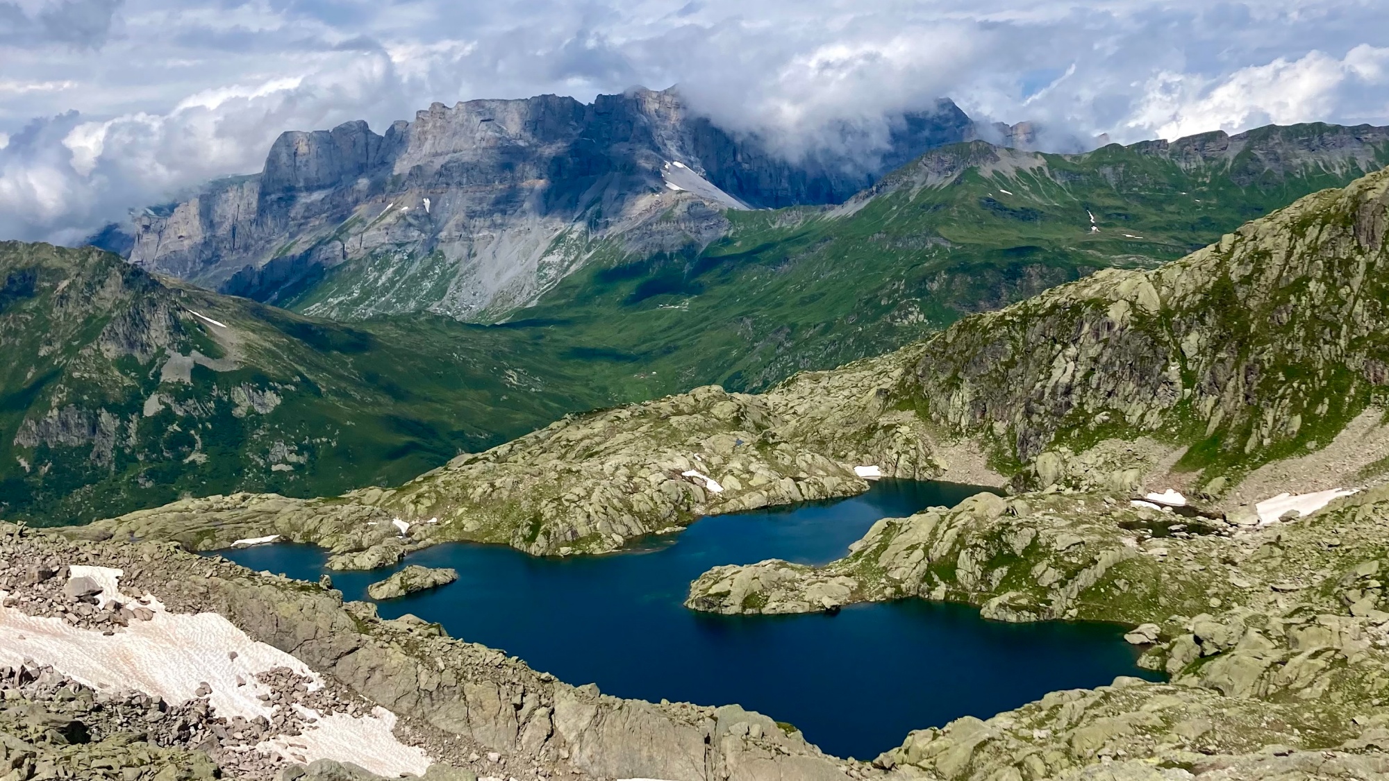
Take the train to Servoz, head across the village centre and then towards les Moulins d’en Haut, from where you start the ascent to Lac de Pormenaz. After the Chalets de Souay the trail includes a few ladder sections, so proceed only if comfortable with such terrain. Alternatively, you can avoid the ladders by taking the same path up as proposed for descending via the Chalets des Ayères. The route is steep in both directions but rewards with stunning views as you enter the area of the Fiz mountains.
Croix de Fer from Le Tour
- Distance: 15.5 km
- Elevation Gain: 1,108 m
- Difficulty: Moderate to Challenging (top section not recommended for those without a head for heights)
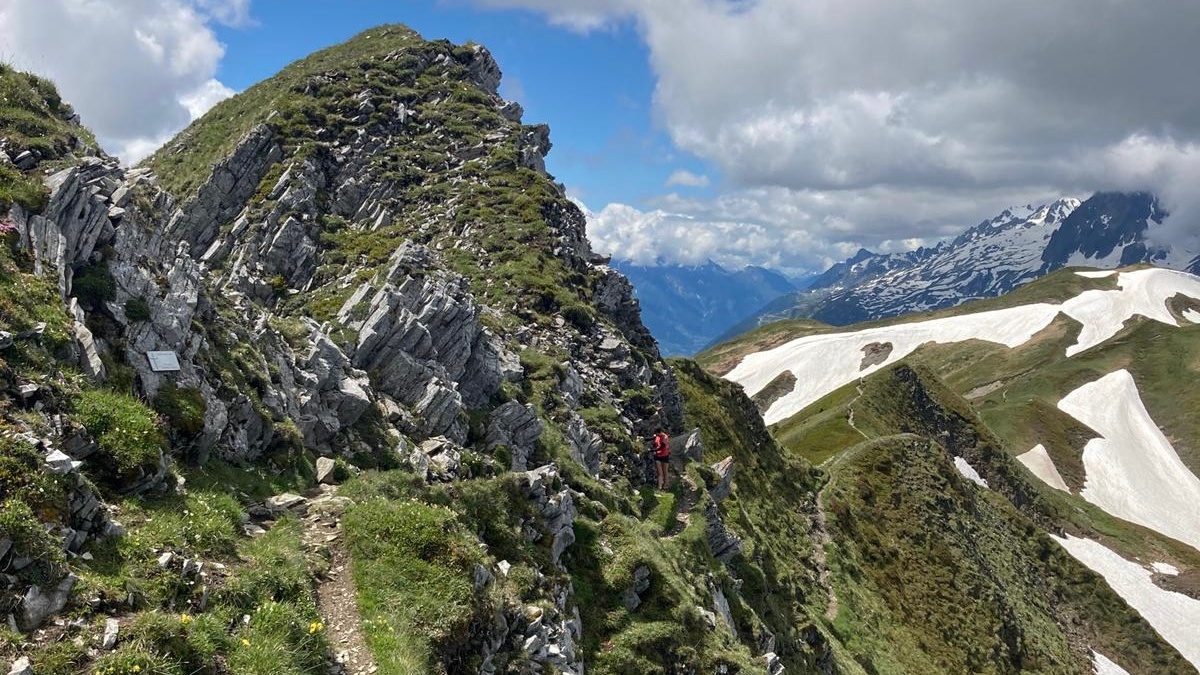
Begin at Le Tour and ascend through the forest towards the Aiguillette des Posettes. The climb is gradual but offers stunning views of Mont Blanc, the Emosson dam, and the Le Tour ski area. Once at the top, enjoy a panoramic 360-degree view taking in the Mont Blanc massif, the Aiguilles Rouges and the mountains lining the Rhone valley in Switzerland. Follow the path towards Col de Balme where you can straddle the border between Switzerland and France. Continue left along the path for about 1 km until you reach the final ridge line. The terrain is not too technical but may be challenging for those who don’t like heights, especially as you approach the cross itself, which provides excellent photo opportunities but requires caution. Return via Col de Balme and optionally follow the ski piste trail downhill for a fun descent, avoiding the bike path.
Col de Salenton from Le Buet
- Distance: 26 km (towards Servoz) – 31 km (towards Chamonix)
- Elevation Gain: 1,457 m (towards Servoz) – 2,164 m (towards Chamonix)
- Difficulty: Hard
This challenging route starts with a train ride to Le Buet. From the station head up to Buvette de la Cascade de Bérard. It’s worth taking a detour to explore the legend of local counterfeiter, Joseph Farient, who lived in a nearby cave and became something of a Robin Hood figure. Continue on the path past the Refuge de la Pierre à Bérard, where you can get light refreshments (cash only). Rather than following the path to the right towards Mont Buet, go left to Col de Salenton, cross the col and follow the stunning, playful trail all the way to Refuge Moëde Anterne.
This is a good place to get fresh water and decide if you have the strength to climb more. If you do, follow this route and head down into the Diosaz valley and then up to Brévent and down to Chamonix. Otherwise, follow the trail towards Servoz, from where you can take the train back to Chamonix. The views are extraordinary and the trails are generally quiet. Make sure to download the route and carry a map or GPS watch, as there is often no signal in most places, so don’t rely on your mobile phone. Be sure to take lots of pictures. We totally recommend doing this route in this order, not in reverse, as the uphill to Col de Salenton is on big rocks and is not exactly runnable.
Additional recommendation
For more routes in the Fiz area, consider exploring the routes of the “Trail du Tour des Fiz,” which takes place every July and connects various mountain huts. You can also explore past routes from the “Trail des Aiguilles Rouges” races and the “Marathon du Mont Blanc” for challenging and scenic trail running experiences.
Family runs
We highly recommend the “Tour des Buvettes,” ideal for shorter runs with kids and teenagers. Discover mountain huts that serve delicious lunches such as Chalet La Floria, Le Chapeau, and the Cascade du Dard. Find the closest starting point, hike up, enjoy lunch, and slowly jog down. Remember to phone ahead to book your spot and always allow extra time for a leisurely experience.